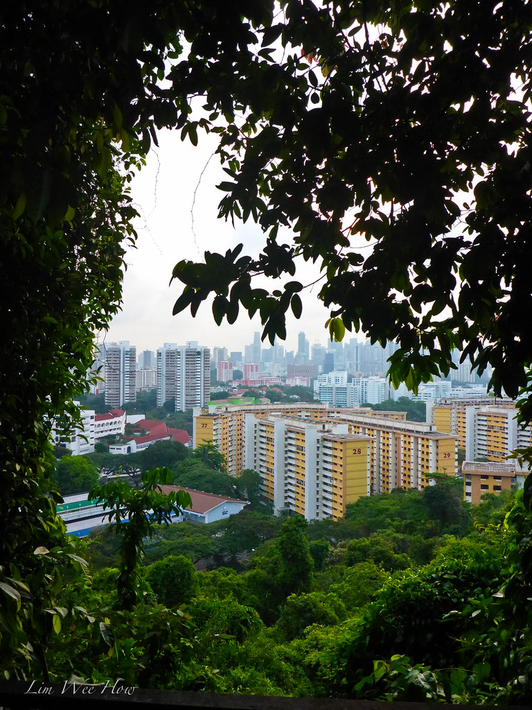
I guess apart from some of the hilly areas around Bukit Timah, the Southern Ridges is another area that has been set aside by the government as nature reserve and designed to be linked up to allow for continuous walk, with scenice bridges and pathways.
So how does the hike look like?
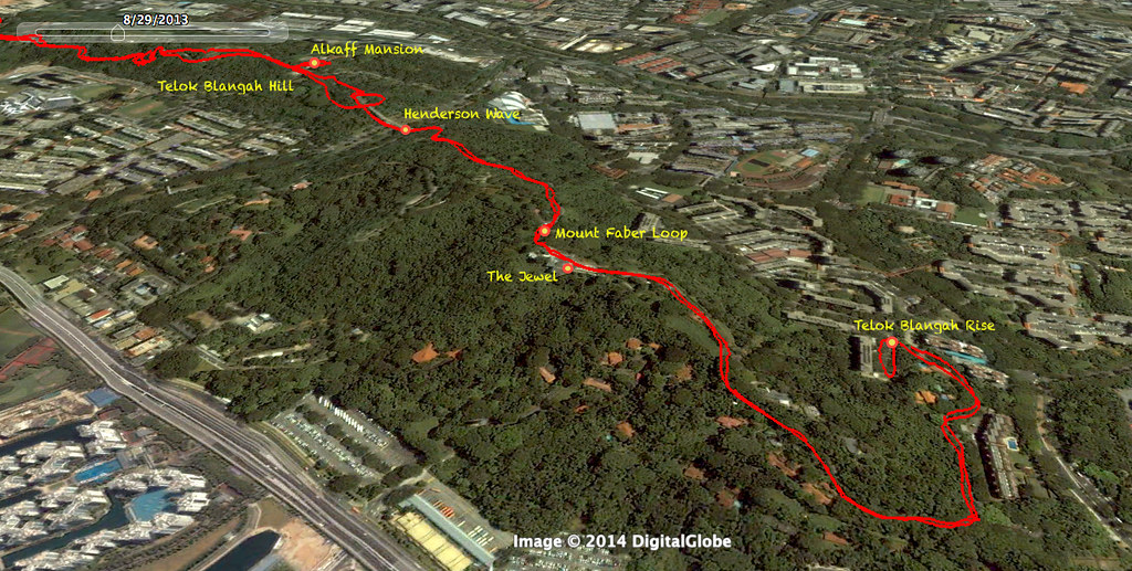
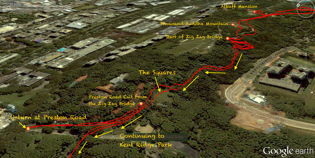
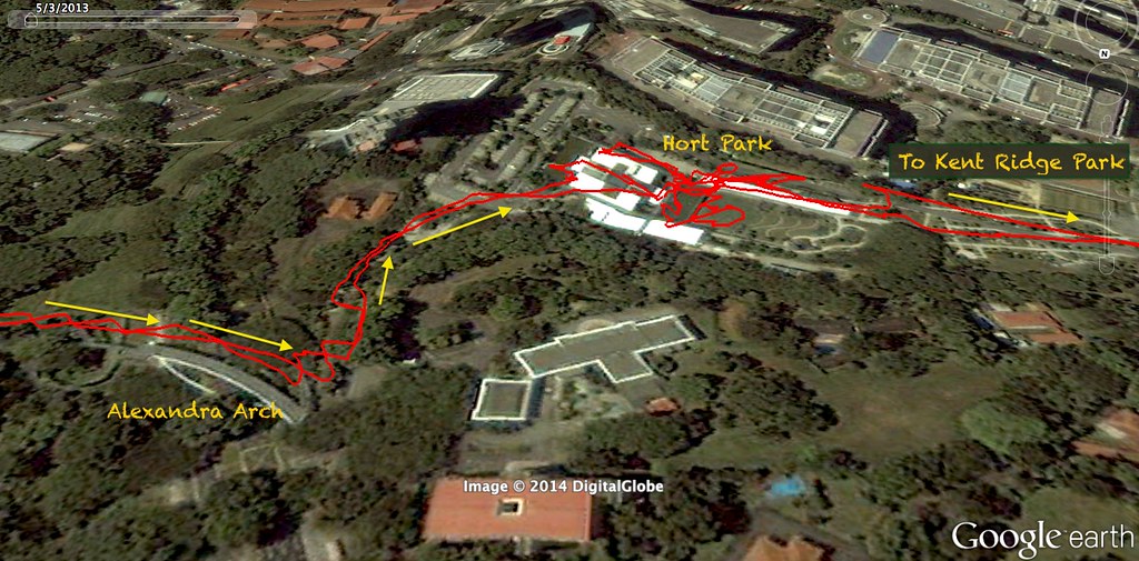
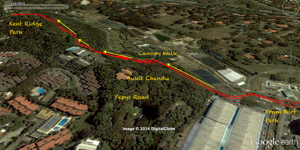
Here is the actual GPS track of our hike on this day. Click on the photo below and Zoom in after that to see the enlarged Google Earth map.
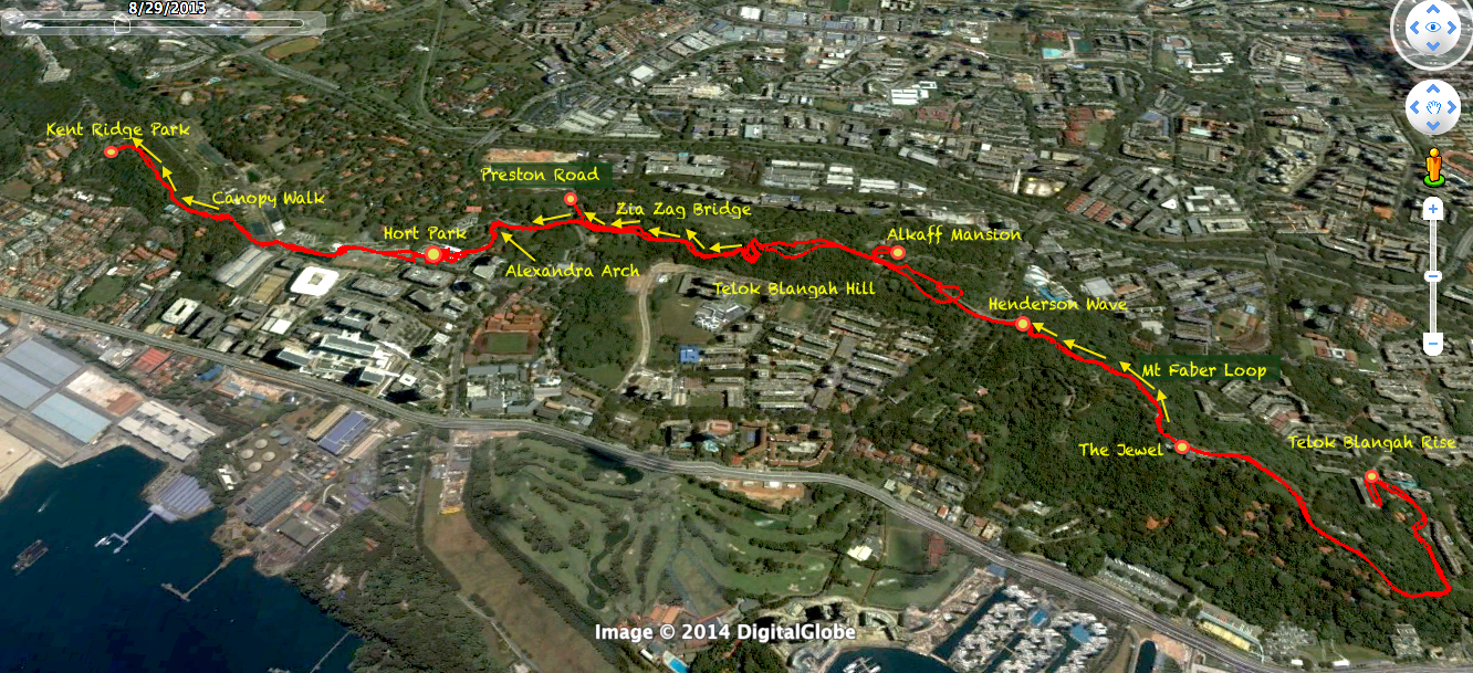 |
| The Actual GPS track of our hike today |
For those who are familiar with Strava, here is the Strava link to this hike of ours. Very interesting GPS information and map data. Give it a click and see lah.

How far was the whole hike?
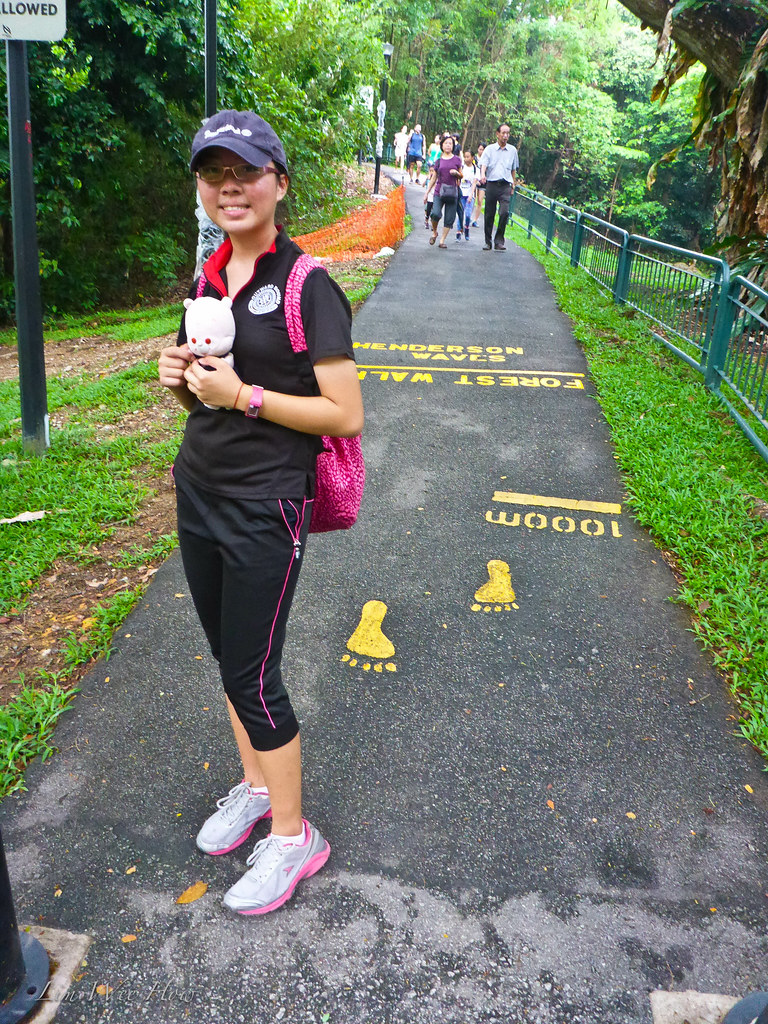
Well, it all depended on how far you would like to go. It could easily hit 10km one way out if you decided to continue walking down from Kent Ridge Park through Vigilante, to NUS through South Buona Vista Road, making the to and fro journey about 20km. On this day, our hike was about 15km. I remembered previously we only did 11km. But remembering that for training purposes, it was important simply to condition the legs to keep going continuously for a certain critical number of hours.
Preparation for overseas hiking?
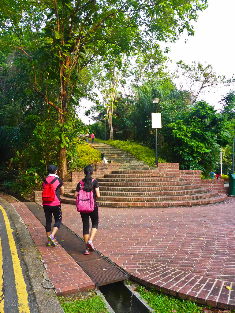
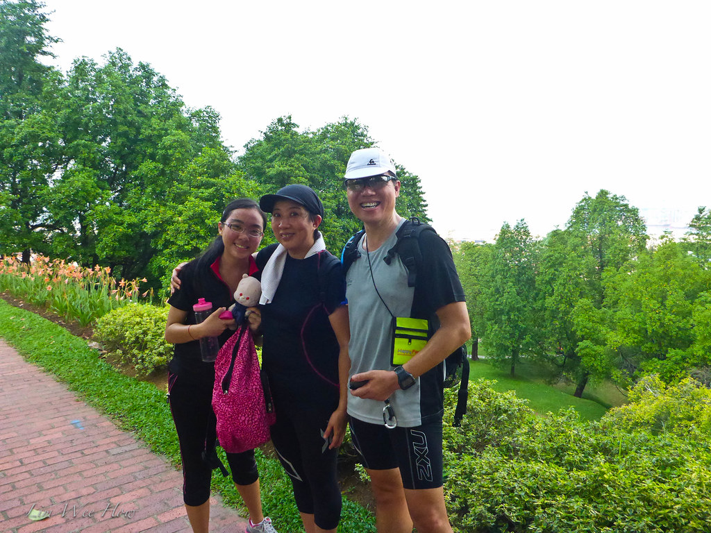
We last did this Southern Ridges walk a few years back when we were preparing for our Nepal trek with the children. And today, Ah Li just happened to suggest that we do it again, this time in preparation for Kinabalu. So we just did it, although it was just only three of us. The main thing about trekking and hiking was, one had to condition the lower limb muscles for continuous walking and climbing, both up and down, for at least a good four hours or more. For longer treks, the timing may even be longer. Although in Singapore, we could never attain that kind of undulating terrain found in the Himalayan ranges, this was the best thing we could do.
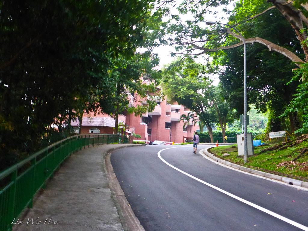
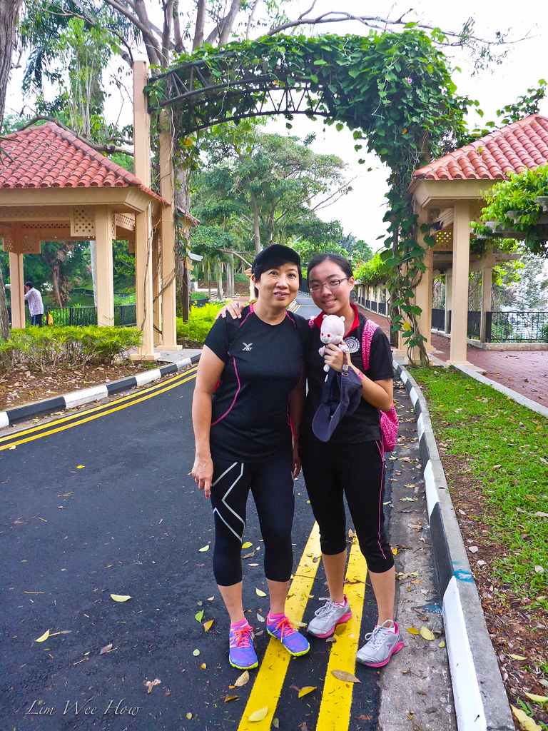
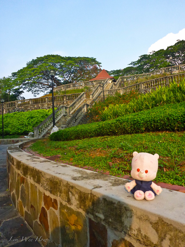
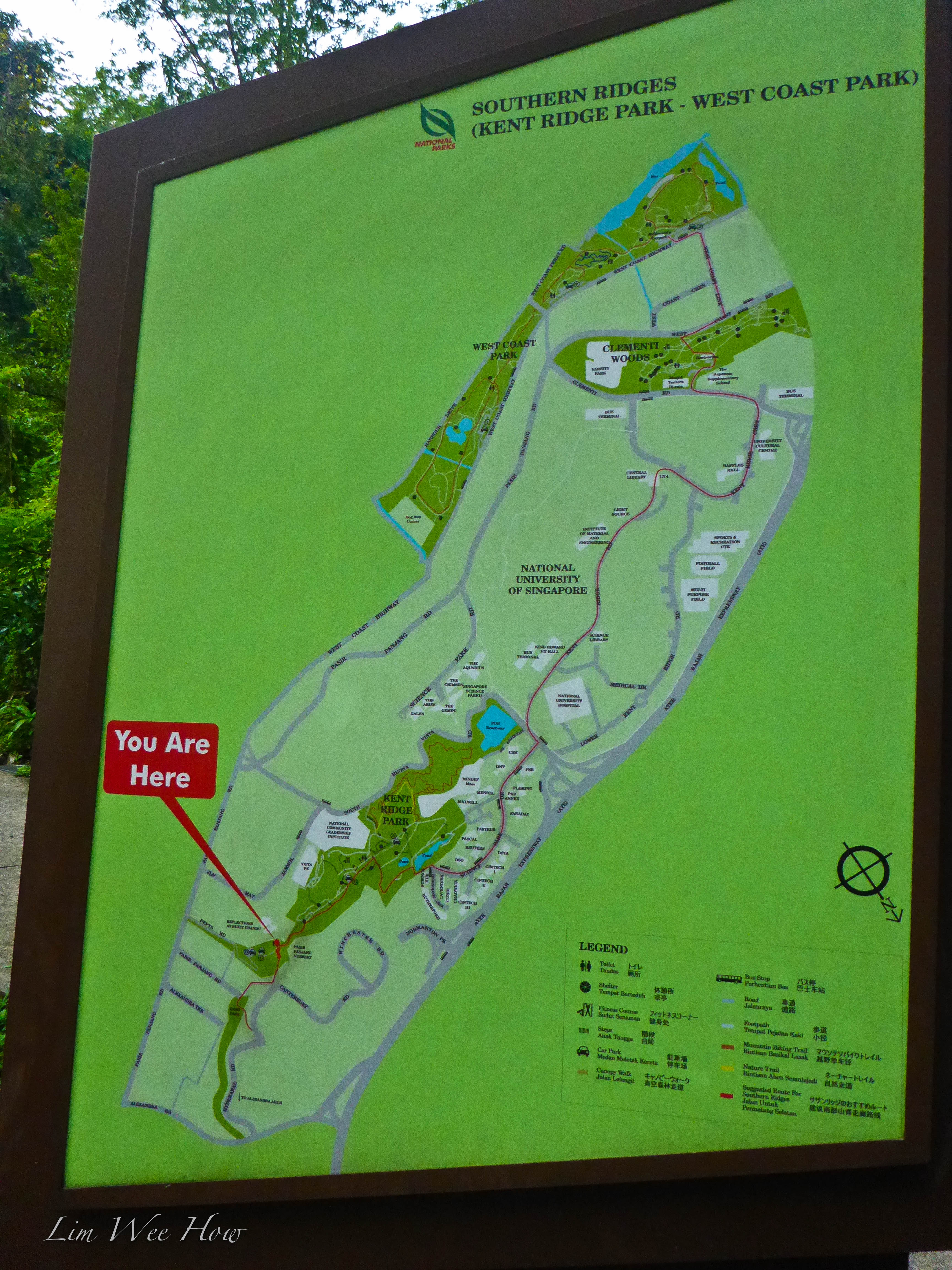
The Start at Telok Blangah Rise
The best way to do the Southern Ridge walk was to start from the foot of Mount Faber. Where to park? Telok Blangah Rise Blk 42 car park. It was the best-kept secret (until now). On Sundays and PH, it was free, and there was plenty of parking spaces.
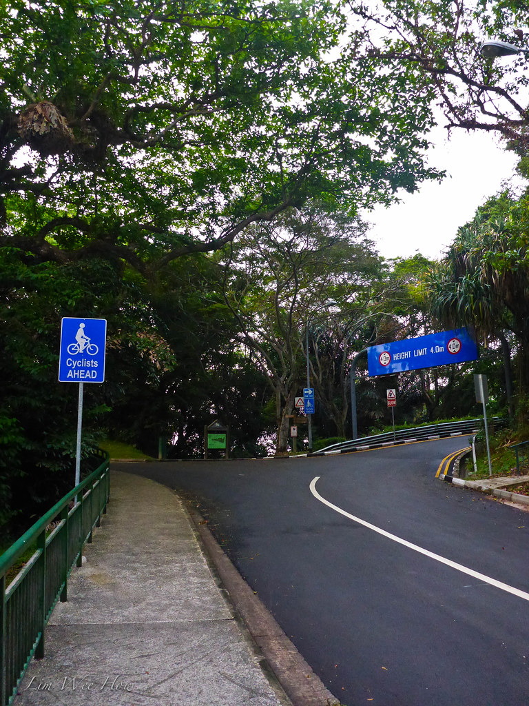
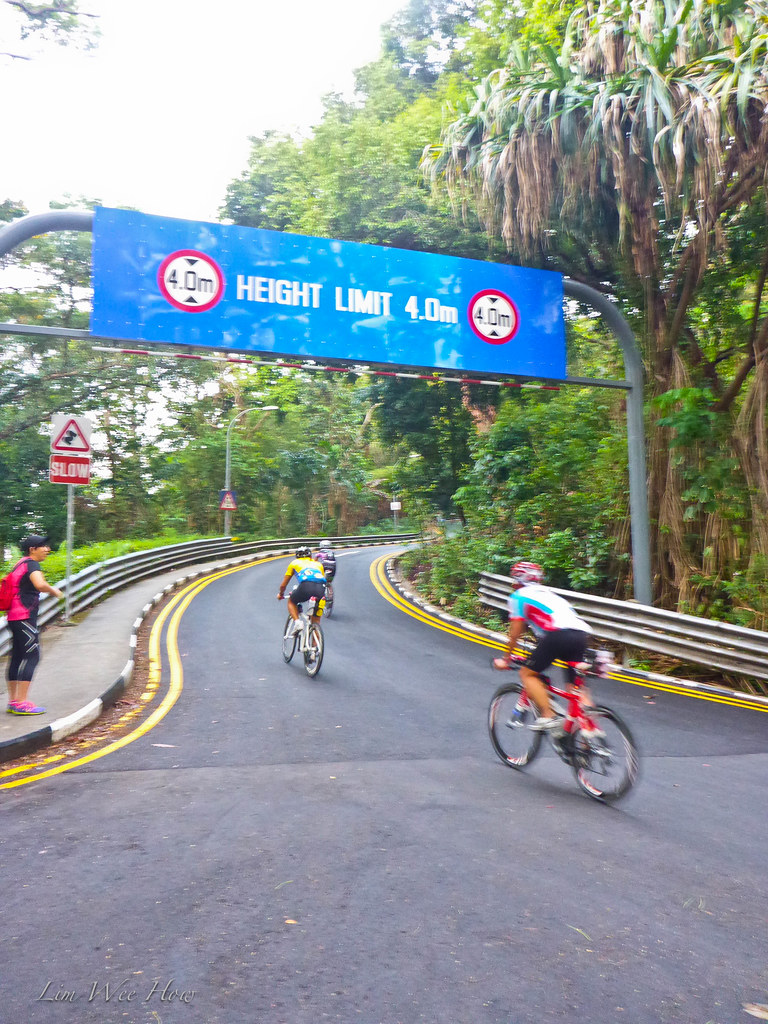
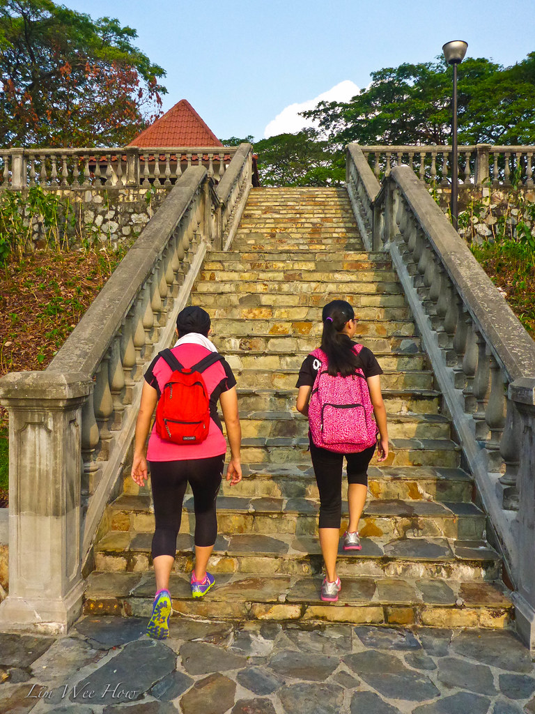
So 7:15am this morning we set off from the carpark at the foot of Mount Faber and started walking up the steep side of Faber. It was nice and cooling, and the walk was punctuated by shouts and grunts of the occasional cyclists either speeding up the steep side, or struggling up the same.
 |
| The dreaded sight for many cyclists... the right turn up meant a one way ticket to the top. |
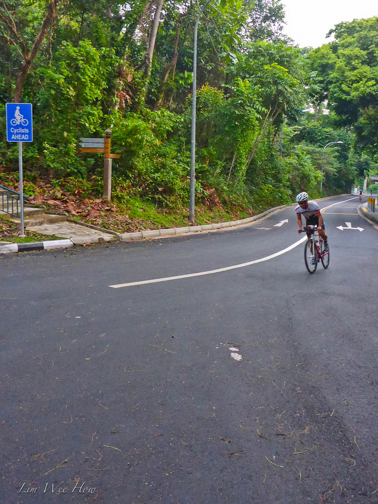 |
| A fast cyclist starting up.. |
 |
| Serene beating-gas to the cyclists going up... |

On this day, there wasn't any 'Wah lau'-ing from three of us, for we were leisurely walking up. I purposely strapped on my Heart Rate strap, and put on my Garmin forerunner 910XT watch, and carried along my Garmin Oregon 450 hiking GPS to capture the necessary data for the walk, and also to allow me to see how my heart rate was doing along the hike. Thankfully, the HR didn't need to go up too high throughout the walk. Of course, after a recent fall and multiple injuries, I was left with a weakened left hand and a severely lax left ankle. But nothing daunting enough for me not to attempt the hike with the enthusiastic Ah Li and Serene.
"Ah Li, here is the toughest part of the steep side of Mount Faber," I pointed out. "We always suffer like siao when we cycled here. And here this bay, it's for those who needed to rest for a bit of breather to push their bikes to."
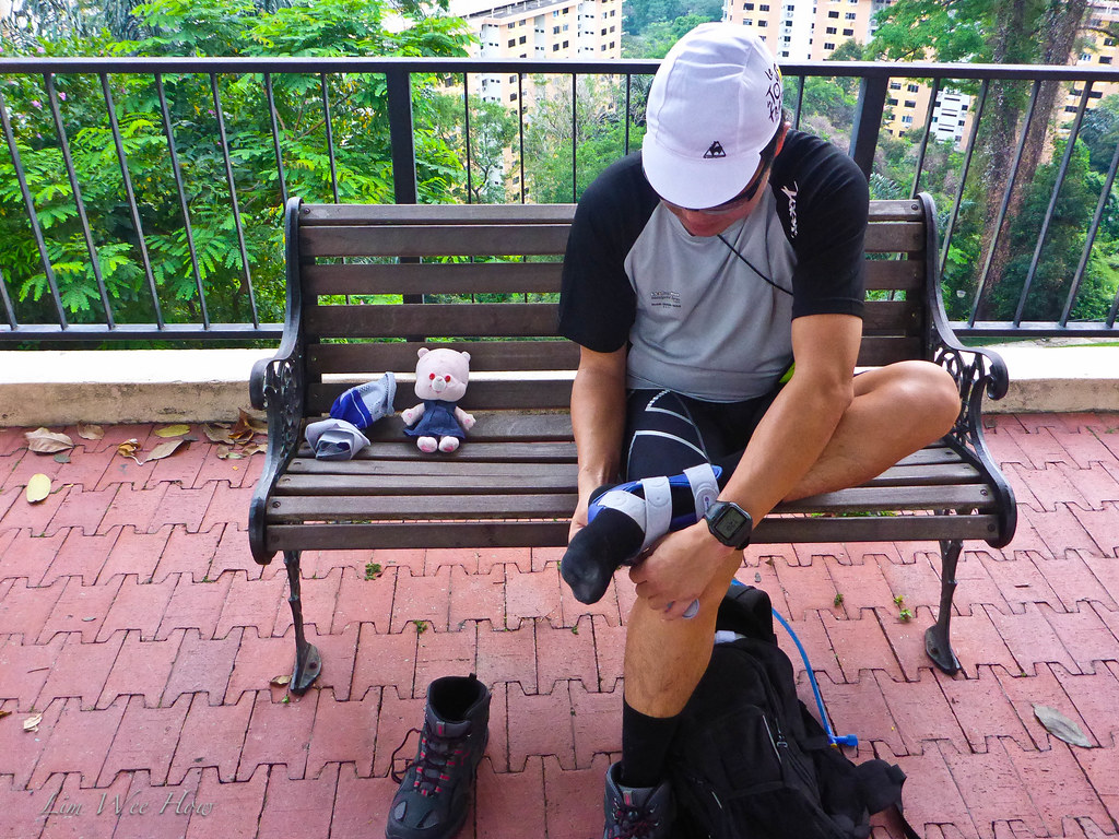
"Ok, wait a while, let me change to my ankle lock here. Ah Li, you hold the camera for me first."
So it was interesting what happened when a teenager had a camera in hand.
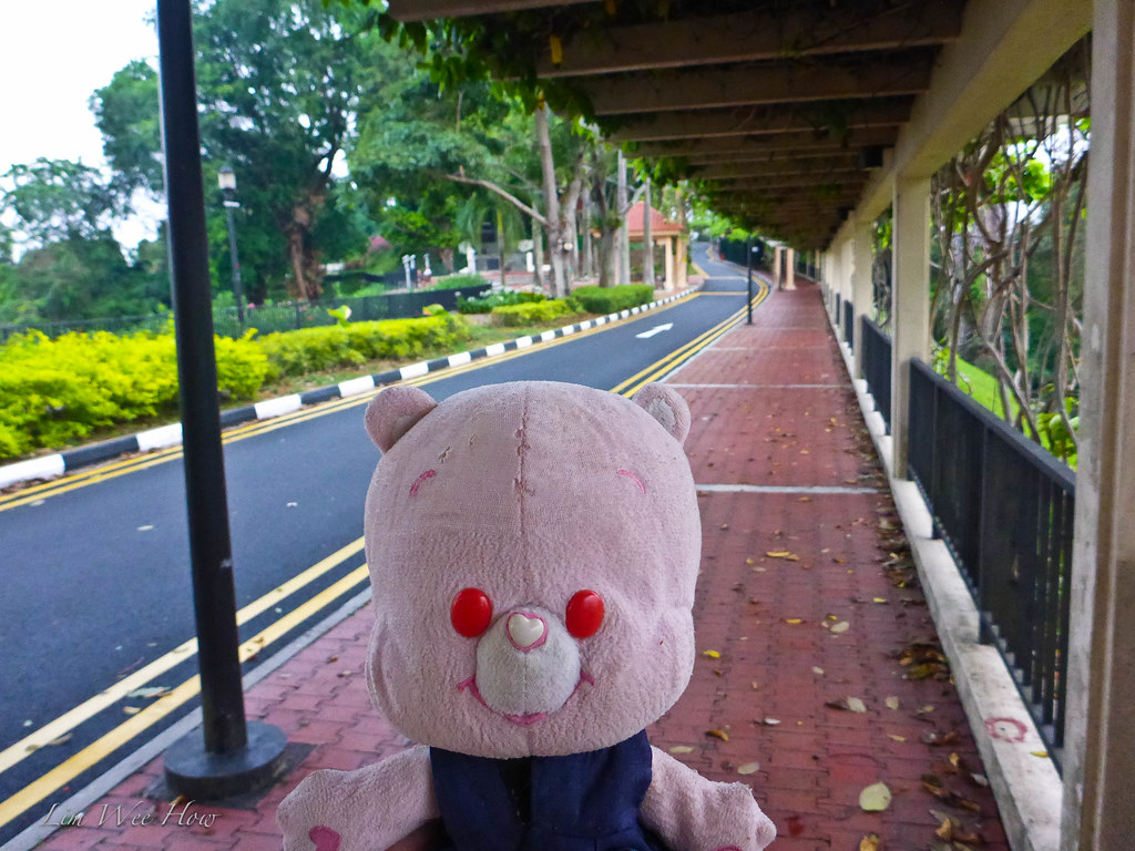
 |
| Her favourite Yi Mao, looking down at Telok Blangah. |
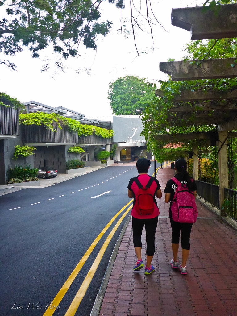
 |
| Yi Mao getting ready to walk to The Jewel. |

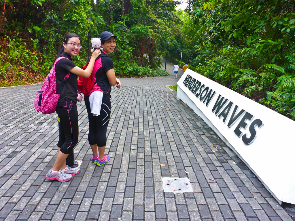
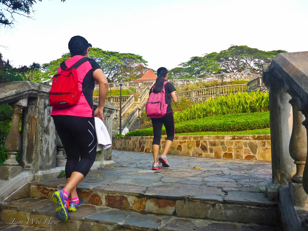
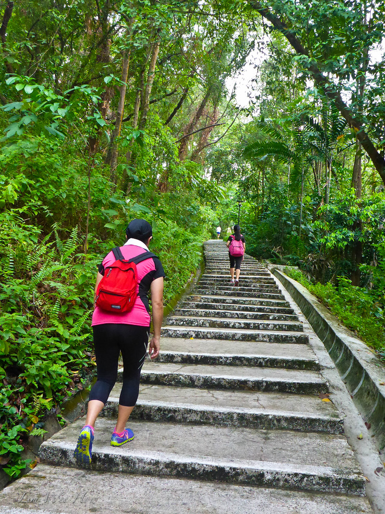
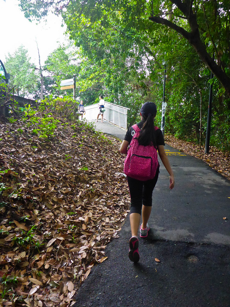
I decided that we would take the right turn down Mount Faber Loop to descend to the Henderson Wave. It was easier and much shadier. Of course, at this time of the morning, cyclists were still aplenty, breathlessly pumping their pedals in their quest for the ultimate timing.
Here was how we walked to Mount Faber and from the top through Mount Faber Loop to the Henderson Wave.
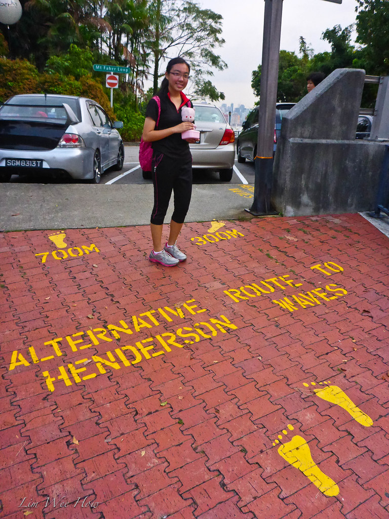
"Ok, Ah Li, here. This is the Alternative Route to Henderson Wave," I said.
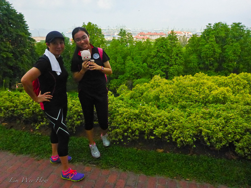
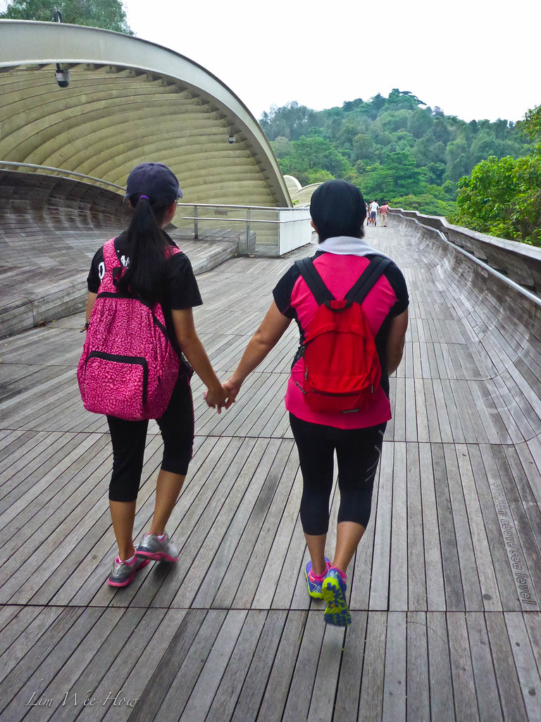
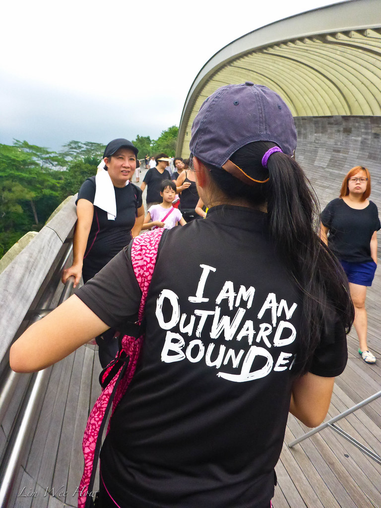
This young lady was most enthusiastic about the Henderson Wave. Although we had walked it before, but she simply loved doing it. And the highlight of this hike was of course this wavy bridge.
Until now, the walk had been uphill from the foot of Mount Faber. But from this point onwards it was down all the way. Easy peasy, really. I knew there would be more climbs later. But for the time being, we just went at a steady pace and enjoyed the nice scenery from up here.

"Hey look, Li! A frame for the flats below! In photography we always try to look for framing." Probably wasted advice there. But I still dished it out nevertheless.
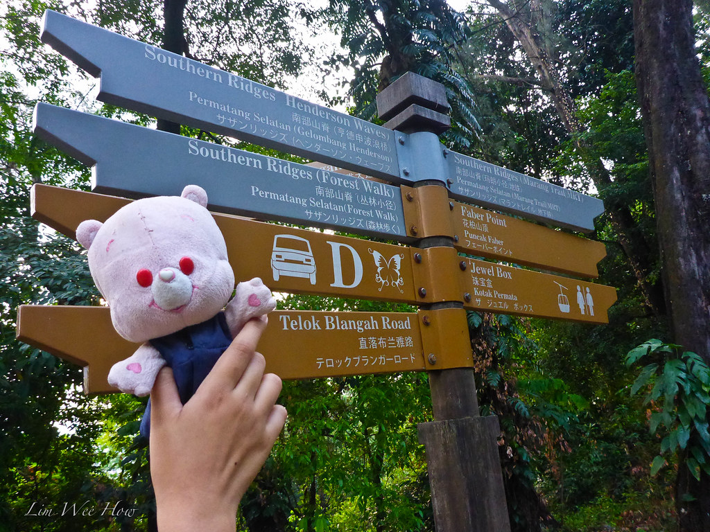
The signboards were very good. One could never get lost as long as one followed the signboards. They would even show how far the distance to the next point. That was really good. Hmmm.. I didn't remember seeing such good signs that few years ago. I might have missed them then.
 |
| Of course, Yi Mao had to photo-bomb my shot. |
The Henderson Wave!!
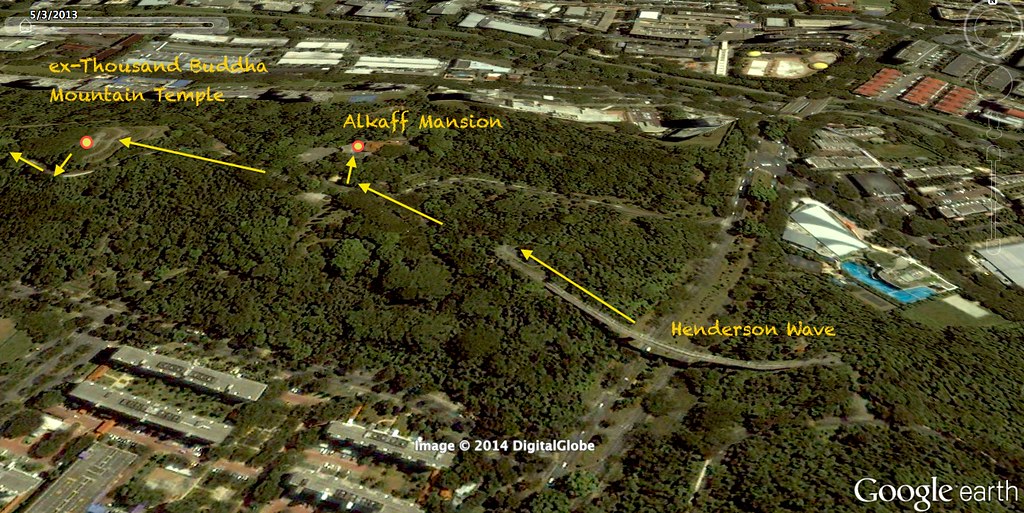
So there we were, the right turn into the Henderson Wave. It wasn't that crowded at this time, except for the few up here for their morning walks. The Henderson wave was an up-sloping bridge that linked Mount Faber to Telok Blangah Hill. I still remembered years back when my parents brought me here as a small little boy, Mount Faber and Telok Blangah Hill (previously known as Thousand Buddha Mountain 千佛山 with a temple right atop it that I could vaguely remember going to when I was a young boy) were linked. But the ridge was cleared to make way for a huge road that now connected Pasir Panjang to Telok Blangah. More of that when we arrived at the section.
Walking up the Henderson Wave would probably not bring my heart rate up much beyond 130. But cycling up the incline would be quite something else (don't let my NEA friends hear me say that, because one is not supposed to cycle on the bridge, but to dismount and push one's bicycle across).
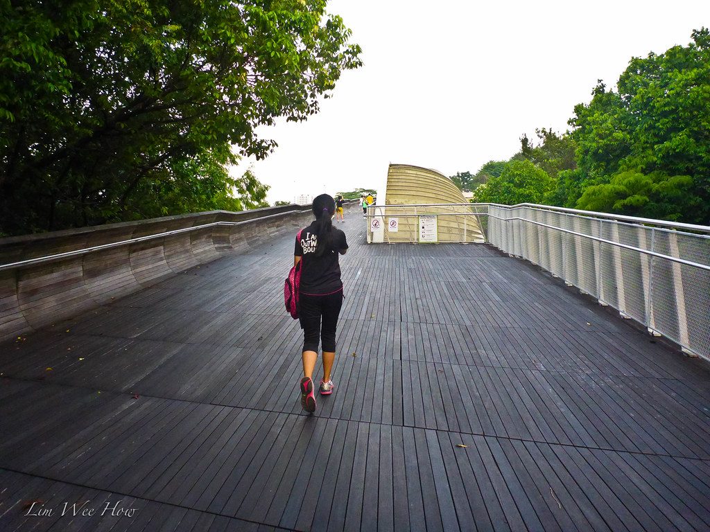
Enjoying the slight inclined walk up the Wave.

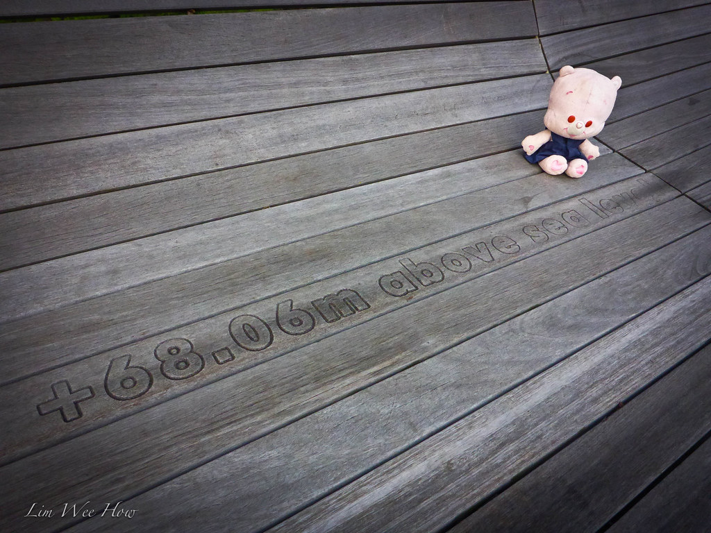
What was interesting was, at every interval along the plank-lined path, there would be a figure on the floor indicating the exact altitude. I had never seen these. I thought these were very good information for those walking up. I took a look at my Garmin Oregon. It registered a 75m altitude when the board said 68m. Quite close, I must say.
Telok Blangah Hill
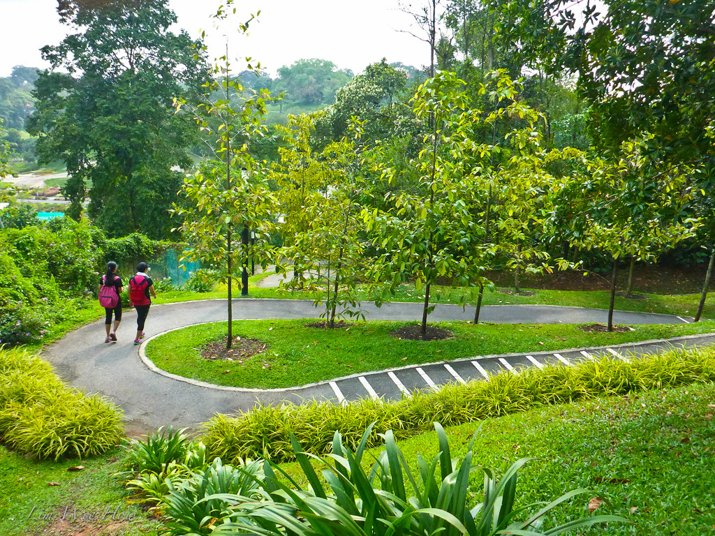
Once we crossed the Henderson Wave, we arrived at Telok Blangah Hill. The descent to the main Telok Blangah carpak mid hill, could be taken either by a inner, smaller pedestrian-only path on the left, or by the wider, but longer winding path on the right. We took the wider one.
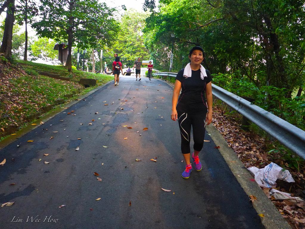
"Pa, the road is so wet here," said Ah Li. "You said you all sometimes cycle down this windy road. Won't it be dangerous because it is slippery?"Good question, Ah Li. Actually yes and no. Don't cheong fast fast lor, and we would be safe. Serene must have been feeling fresh on this morning for she started a slow run from this point all the way to Alkaff Mansion.
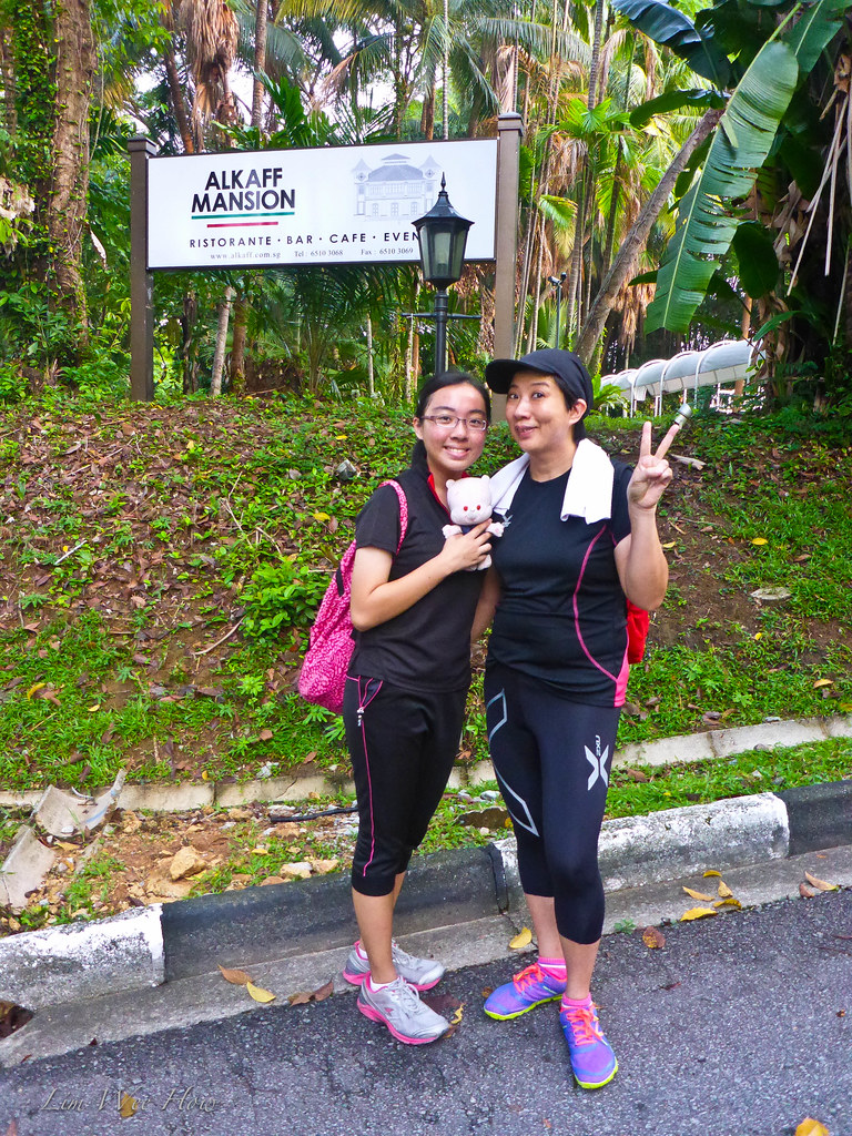
Alkaff Mansion
The Alkaff Mansion had a really interesting history. Here was the account from the site remembersingapore.wordpress.com:
[click on the photo below to go to the site]

"Occupying a landsize of 780 square meters on top of a small hill at Bukit Jagoh (now known as Telok Blangah Green), the Alkaff Mansion was a holiday villa built by Syed Abdul Rahman Alkaff to entertain their customers and guests.Syed Abdul Rahman Alkaff (1880-1948) was a Yemeni trader who came to Singapore in the early 20th century. The Alkaff family was famous for their regional businesses in spices, sugar, coffee and other commodities. They also had vast property interests in other parts of Singapore such as Pasir Panjang and Henderson Road, and owned a beautiful Japanese-styled Alkaff Lake Gardens near MacPherson Road.After the Second World War, the Alkaff family sold much of its properties, including the Alkaff Lake Gardens, in a bid to revive its struggling businesses. Alkaff Mansion, built in 1918, was abandoned and left forgotten until 1990, when it was leased to Hotel Properties Ltd for redevelopment into a fine-dining place.The venture lasted more than a decade when it was finally closed down in 2003. The mansion was left empty once more."
On this day, Alkaff mansion sat silently a huge giant of a Moorish palace, while an elderly Chinese couple stood at the foot of the staircase doing their Taiji. We walked up the steps to the ground of the mansion. Of course, the mansion was no longer left empty. There was a restaurant there, but it wasn't open yet.
"Ok, let's continue to walk." said I.
Mountain of a Thousand Buddhas 千佛山
Some more history of the Telok Blangah ridges. So as I researched, I found that the whole southern ridges were formed by a series of at least seven mountains. And over the years, some of these were levelled or partially levelled to make way for new roads and new developments. As a young boy, in the 70's I remembered my parents bringing me to this part of Telok Blangah Hill known as Thousand Buddha Mountain 千佛山. Apparently the old name for this part was Mount Washington, atop which a Buddhist Temple sat until it was demolished later to make way for developments.
Some more history of the Telok Blangah ridges. So as I researched, I found that the whole southern ridges were formed by a series of at least seven mountains. And over the years, some of these were levelled or partially levelled to make way for new roads and new developments. As a young boy, in the 70's I remembered my parents bringing me to this part of Telok Blangah Hill known as Thousand Buddha Mountain 千佛山. Apparently the old name for this part was Mount Washington, atop which a Buddhist Temple sat until it was demolished later to make way for developments.
I remembered walking up the steps like this, the way we did on this day.
 |
| Walking up to Thousand Buddha mountain. |
Later in the evening, as I showed my Mother these pictures, she excitedly nodded her head and confirmed that the place hadn't changed for decades.
The only difference was, there no longer was the temple up there. I hadn't been back here since I was a child. To Telok Blangah Hill, I did. But not up here. And on this day as I reached the top, I instantly remembered this Pavilion! It was exactly where I had a shot of me taken as a boy! Man, I had to go and search for that photo one of these days. Meanwhile, the best I could do today was to take a shot of Ah Li and Serene here, for posterity. Although, there just happened to be a man lying inside the Pavilion trying to do an inversion there.
A history of the Temple here from Pctures.nl.sg (The National Library Board site):
[Click on the picture below to go to the site]
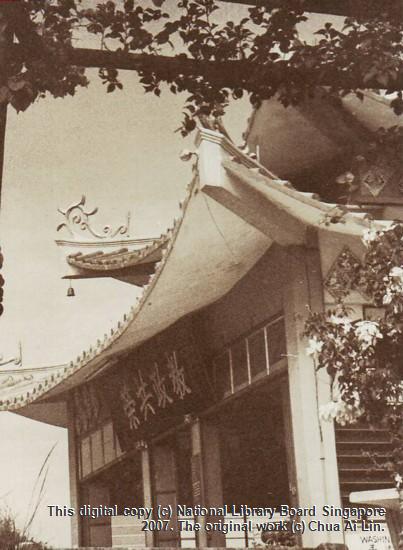
"This is a picture taken in 1969 of the exterior of a Buddhist temple, which was demolished when development was made to the old Alkaff Mansion on Mount Faber. The temple used to be situated on part of a hill named Mount Washington, one of a range of at least seven hills in the Telok Blangah area. The Telok Blangah Hill area was renamed Mount Faber in 1845, after Captain Charles Edward Faber of the Madras Engineers, who was in charge of clearing the overgrowth of flora in the region. In the 1970s with the building of a new road extension, the area was sliced into two sections and one part remained as Mount Faber, while the other part was renamed Telok Blangah Hill. Photograph donated by Chua Ai Lin and displayed at Heritage Roadshow 2007."
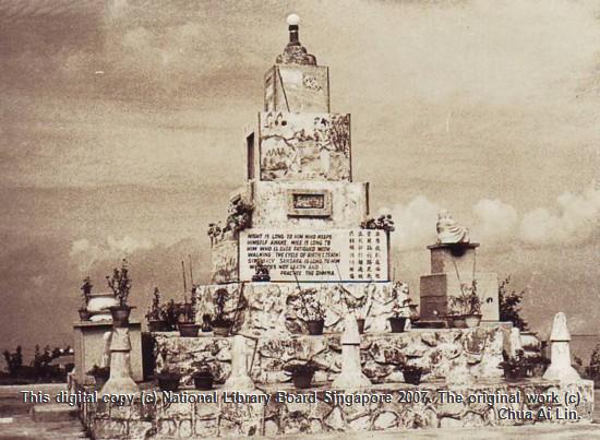
Picture courtesy of National Library Board.
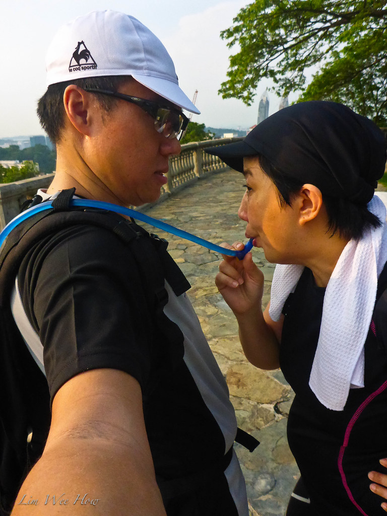
"Thirsty, thirsty!" called out Serene.
As I was the official water supplier, carrying a 3 litre CamelBak bladder in my daypack, my job was to supply water to her. Ah Li was very guai. She had her own water bottle. So I did a half-selfy with my point and shoot camera.
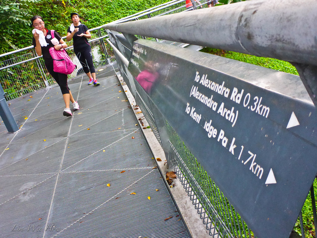
The Zig Zag Bridge (or more politically correctly named the Elevated Walkway'
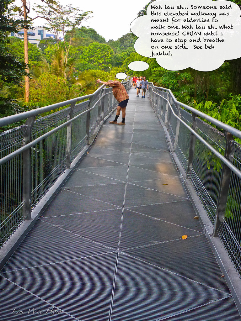
So once we stepped off Telok Blangah Hill, at the bottom of the slope down from the ex-Thousand Buddha Mountain, we come to the metallic Zig-Zag bridge. NEA called this the elevated walkway from Alexandra to Telok Blangah Hill Park. It was designed with a gentle gradient to allow the elderly and the physically challenged to reach Telok Blangah Hill from ground level. This Zig Zag bridge was of a total of 1.6km and it meandered around the secondary forest on the slopes of Telok Blangah Hill.

SQUARES!
Haha, yes. We came to this part on the side slope of Telok Blangah Hill which had concrete laid down in square-shaped lawn. We reckoned it was done to prevent landslide. But it made for a spectacular sight.
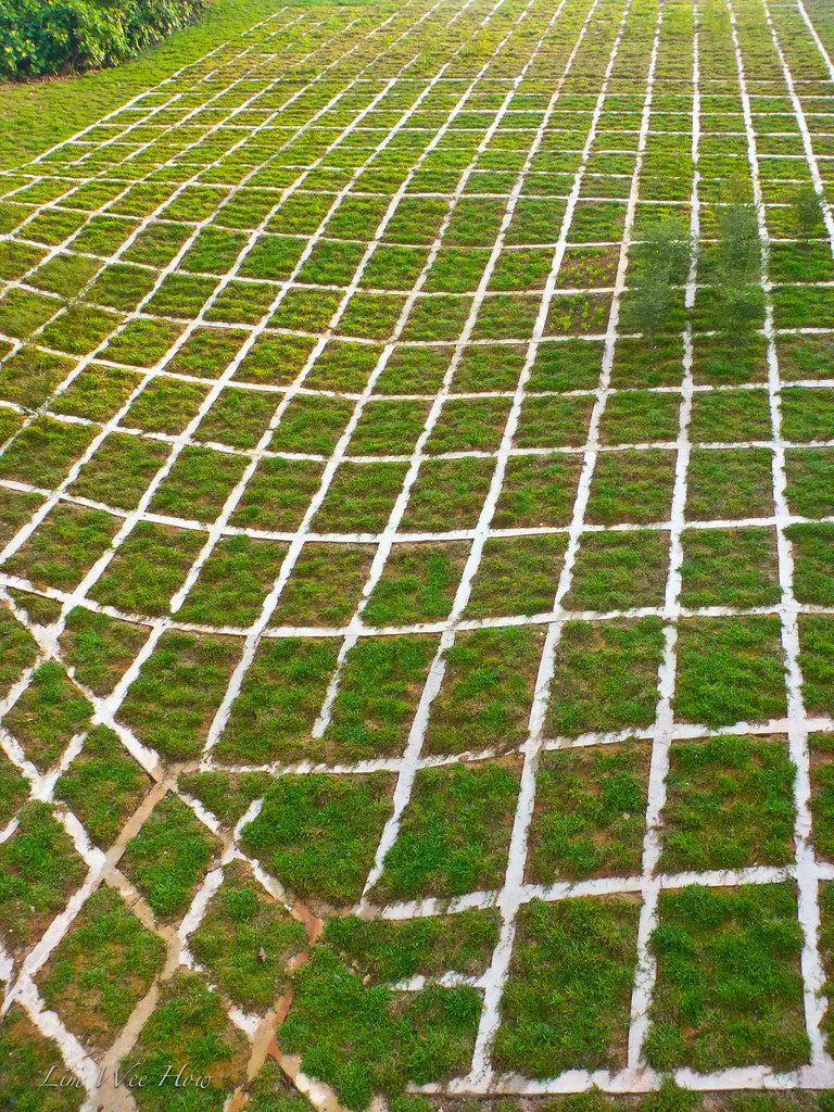
So everyone who walked past here would take a picture. Like the way we did here.
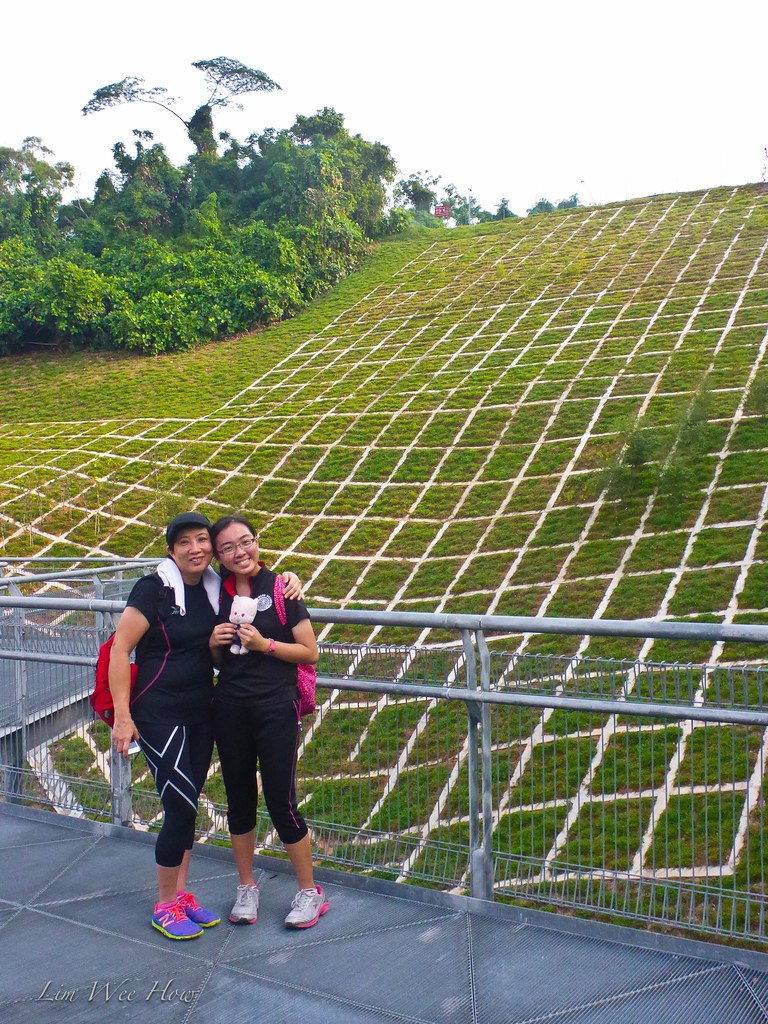
Where were we now ah?
So from what we saw in the Google Earh map, we were at the part right in the middle of the Google Earth map below marked 'The Square'. So we are moving along to Alexandra Arch soon! Keep going.
"Ok, let me try running," again said Serene.
The NPark did well to put up clear signage to the various parts and their respective distances. These made it so easy for hikers to find their ways.
Haha, yes. We came to this part on the side slope of Telok Blangah Hill which had concrete laid down in square-shaped lawn. We reckoned it was done to prevent landslide. But it made for a spectacular sight.
So everyone who walked past here would take a picture. Like the way we did here.
Where were we now ah?
So from what we saw in the Google Earh map, we were at the part right in the middle of the Google Earth map below marked 'The Square'. So we are moving along to Alexandra Arch soon! Keep going.
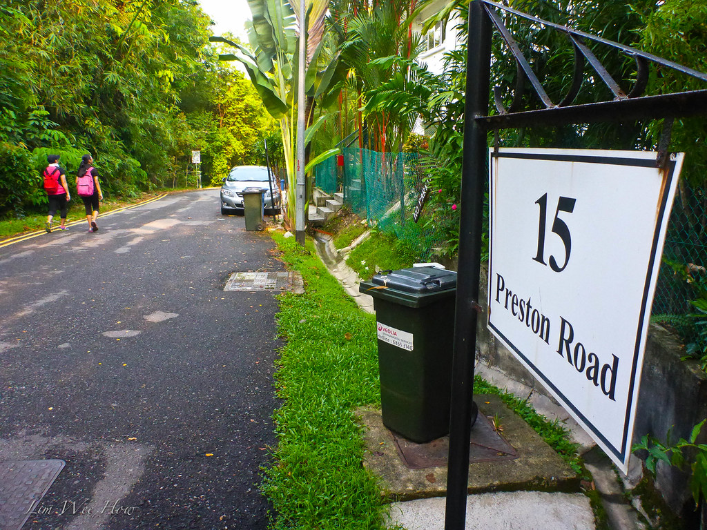
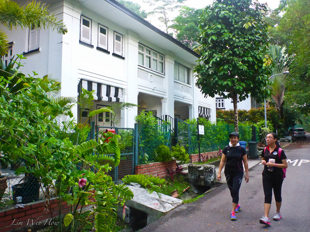
"Ok ladies, here at this part of the Zig Zag bridge, there are some Ang Moh Black and White houses. Let's turn right and explore them, shall we?" I suggested.And so we did, taking a right turn and exited the metallic walkway. And what a lovely part of the trail. Preston Road, it was named. Secluded, quiet, serene.. a paradise by itself. The old black and white houses were all rented out to Ang Mohs. And as we walked we could see some of the Ang Moh ladies enjoying a nice holiday morning sitting in the veranda feeding their babies.. others lying down reading a book.

I really liked the Ang Moh houses. The atmosphere, the ambience, as though I was transformed back into the days of the colonial rulers. But somehow, I don't know lah... as Singaporeans, many of us were so caught up in the race to pay this pay that, get this get that, upgrade here upgrade there.. and for our children, to accomplish this accomplish that.. we'd totally forgot to enjoy our own lives, perpetually employing 'I'm so busy I didn't have time' as the standard excuse, in a way not only to obscure one's pair of eyes to what laid on the side to be enjoyed, but also to keep oneself constantly on the moving along the path of constant comfort in hecticity.
Suddenly...

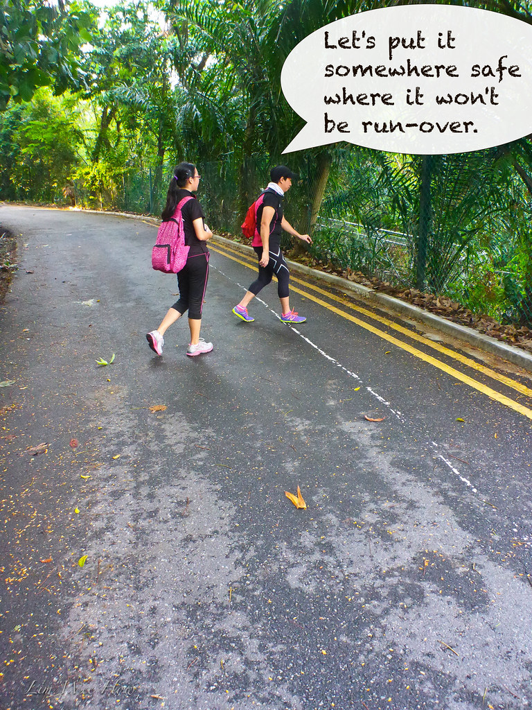
Serene screamed.. "A SNAIL!!!".Yeah, there was a big snail slowly crawling on the tarmac road, enjoying its Good Friday morning stroll. We stopped by and stared at it.
"Cannot lah. Let us move it to somewhere safe, so that the cars won't run over it, " declared the good samaritan.
And the good deed was carried out.
The Breadfruit and the Chinese lady with the Ang-Moh accent...
We came across an interesting looking green fruit on the ground.
"Wow, what's that?" I asked. "Looks almost somewhat like a durian... Be careful don't let it's sap get onto your hands. May develop some kind of allergic reaction one leh.."
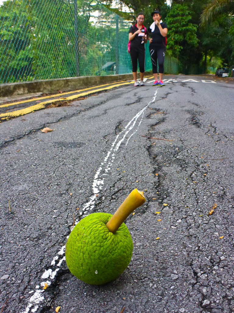
I bent down and picked it up, and passed it to Serene.
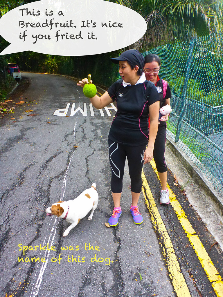
And suddenly on our left a voice rang out: "Come Sparkle, come Sparkle..." apparently calling out for her dog. And this very tanned and sporty-looking Chinese lady came up to us, and in her BEST uppity-British accent, went on to explain to us that that was a Breadfruit and it would taste really delicious when pan-fried with a touch of rosemary and thyme.
Lovely. A lovely morning. A lovely hike. And an equally lovely specimen of a subject of the Great British Empire expounding the gastronomic delights of a Breadfruit.
Yeah.. we reached the beginning of Preston Road only to realise that turning left led to the entrance to Gillman Barracks. That was not the intended route. Looked like we needed to make an about turn back to the Zig-Zag bridge. But the detour was certainly worth all the extra effort, for we discovered for ourselves a sleepy part of Singapore when time was about a few hours behind standard Singapore time zone, and where the second hands of clocks ticked at approximately half the speed of a normal Singaporean clock.
Yeah.. Sleepy lane, sleepy Ang Moh houses, and.... sleepy Ang Moh car...
I found it hard to believe. But my eyes couldn't be telling me lies. Here along this sleepy little lane called Preston Road, even the cars were sleepy. So sleepy their drivers must have been, that the cars must have been parked here for ages, without being driven around..
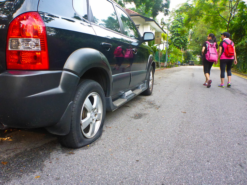 |
| Sleepy car, sleepy tyre. |
Continuing along the Zig Zag bridge..
So we continued our journey to the west. And found the signboard directing us to our destination.
 |
| This was right at the exit to Preston Road. We walked back to the Zig Zag bridge and continued our journey. |
And right away I saw a comical sight, this little old man with his head in between his arms. Must be in deep thoughts lah, him.
The view down the bridge was a carnage of fallen trees, vines, twines, shrubs, and monkeys (haha.. perhaps some monkeys ba, but we couldn't find any on this day, though the signs along the walkway kept warning us of monkeys).
Serene said: "Ah Li, if you fall down from here, the monkeys will grab you and bring you home as toys for their babies."
Very funny. I dare not look down for it was quite high up, a good 56m from the bottom, according to my Garmin.

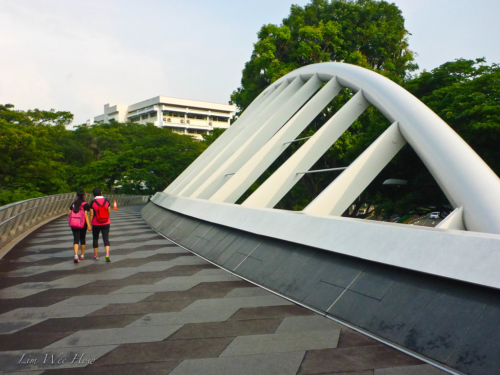
The Alexandra Arch
... and we walked across the hill. And Ah Li kept talking about coming to that bridge that looked like a piece of leaf. Oh that one.. it was the Alexandra Arch. In my opinion, a smaller version of the Henderson Wave, but in its own rights, equally stunning.

From Alexandra Arch to Horticulture (Hort) Park..
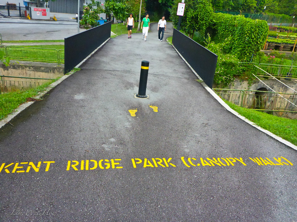
So we were finally here at Alexandra Arch, and walking down the arch we made a left turn to see a sign saying Kent Ridge Park (Canopy Walk). Yes, this was the route through the Hort Park and to Kent Ridge Park.

And the GPS track on Google Earth showed us walking through the Alexandra Arch to Hort Park
At this point at the Alexandra Arch, we had walked roughly 5.5km. The weather was getting slightly less cool. We were also beginning to see more people walking on this track, family with little children, senior citizens walking slowly in groups, young lovers, runners...
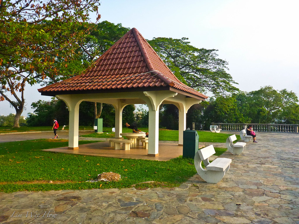
Hort (Horticultural) Park
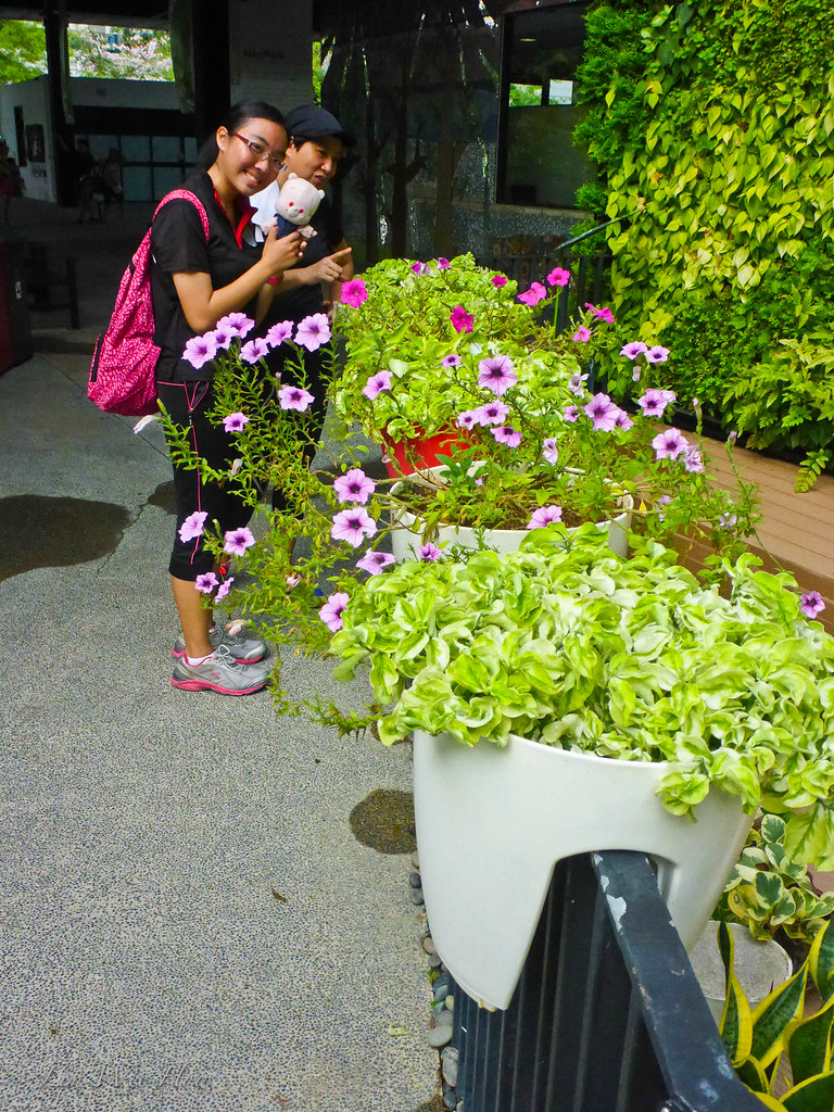
I'd always called this the Hort Park, the Hort Park. Maybe it was because whenever I arrived at this park, it was always very Hot. But today, thankfully it wasn't. We even went into the air-coned botanic shops (well, the ladies did, not I.. I was adjusting my ankle lock outside.. haha) to check out the different types of plants.
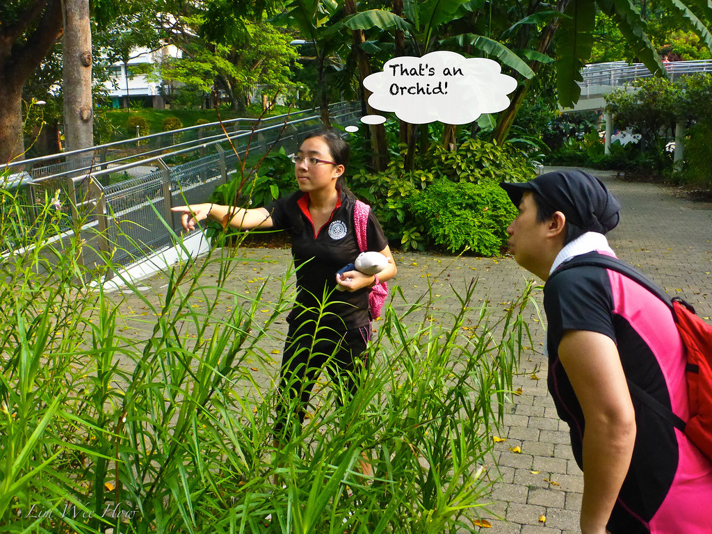
And we found these type of flower pots... very good for hanging over the balcony.
A group of senior citizens walked past and laughed when they saw me shooting this shot through the frame.

The sky was a little overcast as we walked through the Hort Park. And we could see people sitting on the grass, children playing frisbees and more and more people walking in both directions - from Kent Ridge, and to Kent Ridge.

I remembered the last time when I came to Hort Park, I kinda got lost.. couldn't find the way to Kent Ridge Park. But this time round, everything was smooth-sailing. I just followed the signs, and ended up here.. The Canopy Walk.. right at the edge of Hort Park, getting to walk towards Kent Ridge Park.
Not far from here, Ah Li spotted a squirrel running across the path... and up the trees.
"It's very fast ah, Papa!" she said.

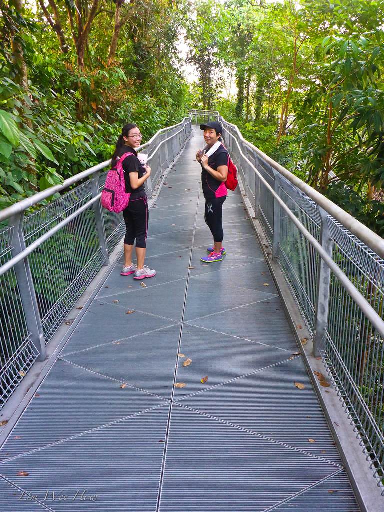
Kent Ridge Park Canopy Walk
 Now I began to understand why they called it Kent Ridge Park Canopy Walk.
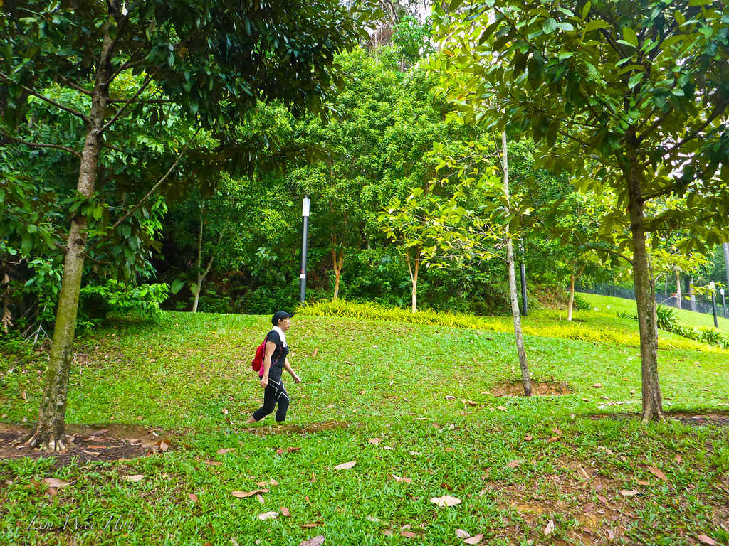
I looked at the sign, and I was impressed that we could actually walk all the way through Science Park, through NUS all the way to West Coast Park. Maybe the next round we would do that.
 |
| Click on this for a bigger photo... |
"Ah Li, keep moving forward. Keep going straight. We would come to Kent Ridge Park. If we walk further down we will come to Vigilante Drive, one of the steepest roads in Singapore we've ever cycled on... But today we will stop just at Kent Ridge Park." said I.

Finally! Kent Ridge Park!
And a very kind fellow park walker offered to take a photo for us..
The History of Kent Ridge Park - The Battle of Pasir Panjang Hill.
 This park would forever hold a special place in my heart. For it recorded a courageous battle between a solitary regiment of Malay soldiers led by Lieutenant Adnan Bin Saidi, as they struggled bravely to stave off the invading Japanese forces in Feb 1942. Here was the history of the Battle of Pasir Panjang Hill, an epitome of bravery forever for Singaporeans to remember in times of crisis.
1. More history from the Site Battle of Singapore 1942 [Click to go to the site]:
2. And from the site NUS Department of Biological Science, "The History of Biology of Kent Ridge Park":
World War II: Pasir Panjang Battle
Invasion of the eastern coast of Southern Thailand and north of Malaya (the then Peninsular Malaysia) at Kota Bahru on 8 December 1941 by the Imperial Japanese Army. They then moved down south of the peninsula, defeating the British Army rapidly wherever they went. After midnight on 9 February 1942, the Japanese crossed the Straits of Johore and landed on the northwest coast of Singapore. They moved down south and reached Pasir Panjang Ridge over the next few days.
The ridge was the site of an epic 48-hour battle between 13 and 14 February, 1942
The ‘Pasir Panjang Battle’ or ‘Battle of Opium Hill’. Opium Hill or Bukit Chandu in Malay, was named after an opium-processing factory which used to be at the foot of the hill. Bukit Chandu demarcated the final defence perimeter. It was a key defence position in Singapore for two strategic reasons:
- It overlooked the island of Singapore to the north.
- It gave access to Alexandra Road area where the British Army had its main ammunition and supply depots, military hospital and other key installations situated.
The frontline on the evening of 12 February was near the site which was to become the current NUS University Cultural Centre, and by the afternoon of the next day, the enemy had reached the gap, the area at the junction of the current Kent Ridge Road, Clementi Road and Stockport Road. A 42-men contingent of the 1st Malay Regiment under the command of Lieutenant Adnan bin Saidi, held off the crack Japanese troops for 48 hours, in spite of heavy shelling and mortaring as they alternatively fought the Japanese and retreated eastwards along Pasir Panjang Ridge. The enemy even tried disguising themselves as allied Punjabi troops to get nearer the defences but the Malay soldiers saw through their ruse and the enemy was thrown back. The last stand was made at Bukit Chandu.
OK Job done! Time to make our way back liao!
So we U-turned here. The next round we would walk further down through Vigilante Drive to NUS and to West Coast Park. There would always be a next round.
 |
| Down the zig zag of Kent Ridge Park Canopy Walk... again. |
And back to the Hort Park... At this time, a group of senior citizens walked past and loudly talked about something like it was raining in Jurong already. We looked up, and true enough, the sky was threatening to open up with dark clouds above.
"Uh oh.. are we going to make it back to Mount Faber in time?" I asked. The ladies just smiled.
Back to Telok Blangah Hill...
Here at this point, we saw that very steep but short road up to the Mountain of the Thousand Buddhas. I made a note to myself to cycle up this one the next round I was here.
And while Serene started running up the slope, Ah Li and I walked behind. And we came to this slope up to the edge of Henderson Wave (Telok Blangah Hill side). A pose of Ah Li here with Yeye and Nainai's Godsons and Goddaughters in the background.
... and up we went.
... through Henderson Wave again..
And FINALLY back to Mount Faber side again.
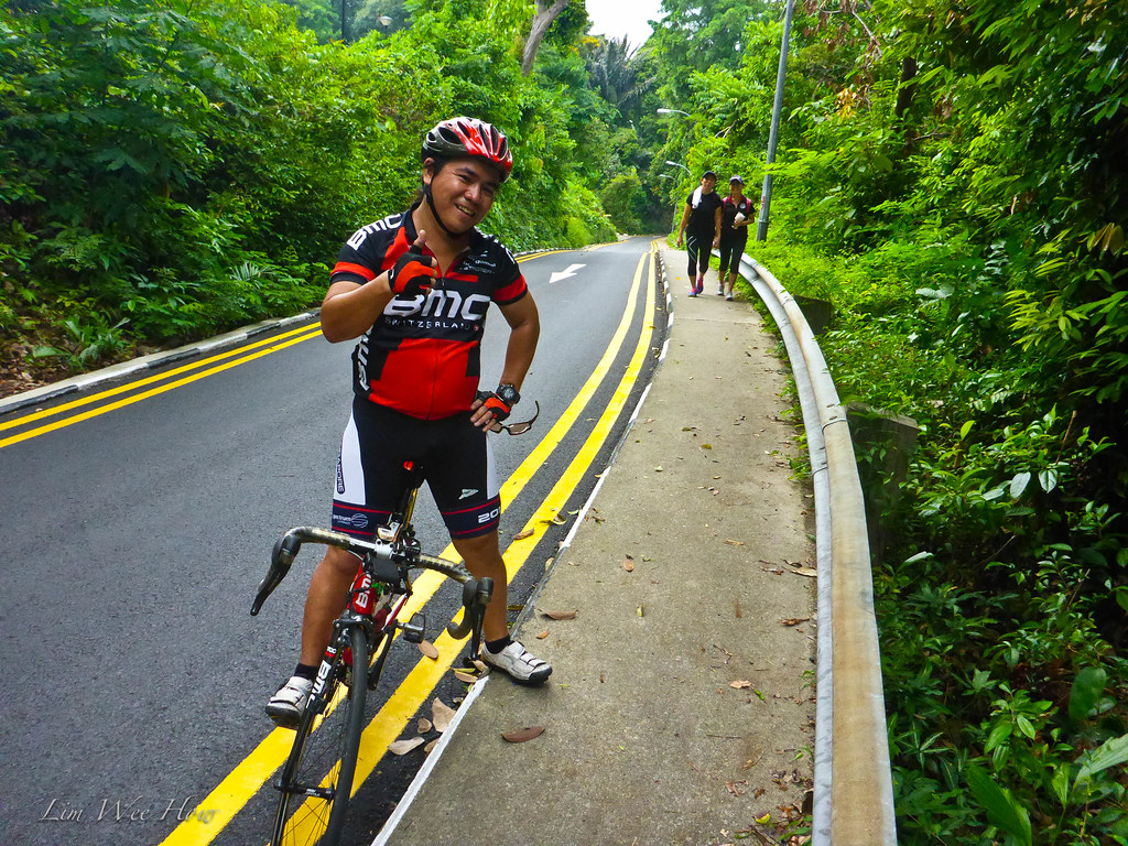
We walked slowly up the Mount Faber Loop and back down the steep side in the reverse direction. And who should we see cycling up the steep side but the bike mechanic Mike from Bike Plus panting on a BMC. As he cycled up he kept shouting to himself: "I hate this bike, I hate this bike!" Haha.. I cheered him on.
Back at Telok Blangah Rise Carpark.
Finally 4 hours and 15.8km later, we came back to our car.
Job done for the morning. Till next time when we do the southern ridge again.
While searching for history and photos of the Thousand Buddha Temple, I came upon your blog. Kudos!
ReplyDeleteOh thank you so much for your kind words. And thank you for bringing my memory back to those lovely years when we walked any where we pleased and we wore no masks.
Delete